New maps of Arthur Ransome’s Norfolk Broads published
New maps of Arthur Ransome’s Norfolk Broads have just been published, showing locations from Coot Club and The Big Six in relation to neighbouring 1930’s roads, railways, and landmarks.
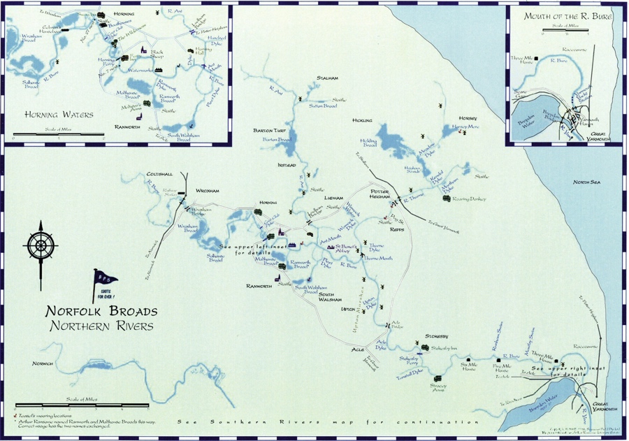
Produced by Mike Field of Wooden Boat Fittings in Australia, the maps are based on the original Northern and Southern Rivers maps in those books’ endpapers, focusing on the waterways and features that appear in the two stories, in order to easier follow the childrens’ travels as you read the books.
Mike Field has previously published similar maps of Secret Water, Wild Cat Island and The Lake – the latter has also received a minor update.
All of the maps can be downloaded free of charge from All Things Ransome, and printed A3 copies can be ordered directly from Mike – full details are here.
Discover more from Swallows and Amazons
Subscribe to get the latest posts sent to your email.